


myStop® Mobile
3.81.32K Reviews
App Specs
- Version
- 4.31.7
- Updated On
- License
- Free
- Downloads
- 500,000+
- Developer
- Avail Technologies
- Categories
- Maps & Navigation
- Platform
- Android, iOS
Screenshots
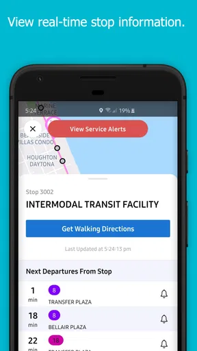
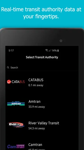
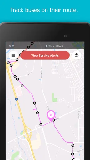
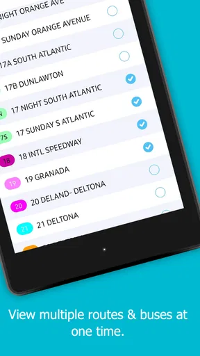
 Analysis by AppCompare
Public transport is one of those things that feels simple until I am standing at a stop, watching the minutes pass and wondering whether the vehicle is late, early, or already gone. That is the problem myStop® Mobile tries to solve. It is a free Maps & Navigation app from Avail Technologies that puts traveler information on a phone, with its main appeal coming from real-time awareness rather than from replacing a full mapping service.
My first impression was positive because the app has a clear everyday purpose. I do not open it to explore a city or plan a long road trip; I use it when I need to understand what is happening with a transit journey right now. That narrower focus can be useful. Instead of forcing a general map application to handle every detail, myStop® Mobile is aimed at the moment when I need to check a stop, follow a route, or decide whether waiting is still sensible.
After spending time with it, I see a practical tool rather than a flashy one. The first week is likely to be the most convincing period because real-time transit information can immediately reduce uncertainty. The more important question, though, is whether it deserves a permanent place on a phone after the novelty disappears. My answer is generally yes for regular riders served by its information network, but with important limits for people who need broad, all-purpose navigation.
What makes the first week useful
The strongest early benefit is the change in how I wait. Without a transit-focused app, I tend to arrive at a stop based on a timetable and then accept whatever happens. With myStop® Mobile, the intended workflow is more active: I check the service before leaving, look at the relevant stop or route, and make a better decision about when to walk out the door. That small adjustment is more valuable than it sounds, especially when the weather is unpleasant or the journey includes a connection.
A realistic example is a weekday trip to work. I can check the service while putting on my shoes, then look again before leaving the building. If the vehicle is approaching, I avoid wasting time. If the wait is longer than expected, I can finish a task, take a different route to the stop, or delay the walk instead of standing outside without useful information. The app does not remove delays, but it can make the delay easier to manage.
The same idea helps students, hospital visitors, shoppers, and anyone who depends on a bus or other local transit service but does not want to memorize every schedule. For a new rider, seeing information organized around stops and routes can feel less intimidating than trying to interpret a printed timetable. For an experienced rider, the benefit is speed: the app can become a quick confirmation tool before leaving home.
One detail I consider especially important is that real-time information should be treated as a decision aid, not a promise. A countdown can make a journey feel precise, but transport conditions can change between checking the screen and reaching the stop. I would still leave a sensible margin for walking, traffic, boarding, and the possibility that a vehicle’s arrival estimate moves. That habit prevents the common mistake of trusting one displayed time too literally.
Worth Reading Before You Choose

EA SPORTS FC Mobile 26 Is a Bigger Football Game, but It Takes Time

Flipboard Shows What News Apps Must Do Beyond the Feed

Switching to Android Auto Means Rethinking Your Driving Routine

Google Calendar Makes a Crowded Week Easier to Manage

Ludo King Makes the Most of the Minutes Between Plans

Baby Panda World Brings Quick Play to Modern Phones, but Its Game Library Feels Busy
The app is also more useful when I organize my routine around the places I actually use. Rather than opening it casually and browsing everything, I would identify the stops and routes that matter for work, school, home, or regular appointments. This creates a repeatable check: open the app, inspect the relevant service, and leave. That workflow gives it a chance to become part of a commute instead of remaining a novelty installed for one trip.
Where it fits beside ordinary map apps
Compared with a general map application, myStop® Mobile has a more focused identity. A broad mapping tool is usually better when I need walking directions, driving options, business locations, or a trip involving several kinds of transport. It may also be the more comfortable choice when I am unfamiliar with the entire area and need visual context around a destination.
The transit-focused approach can be better when the immediate question is not “How do I get across the city?” but “When is the service I already use expected to arrive?” That distinction matters. A general map can show a route, while a specialized transit app can be the quicker place to check the operational side of a familiar journey. I would not replace my regular maps application with it, but I can see why a commuter would keep both.
It is also different from relying on a timetable saved in a note or printed at a stop. A static schedule is useful for planning the shape of a day, but it cannot respond to the uncertainty that makes real-time information valuable. The trade-off is that the app depends on current service information and on the coverage available through the relevant transit system. If the service is not represented or the information is not current, a timetable or official notice may be more useful.
Why it can keep earning a place month after month
The lasting value comes from repetition. I would not open a transit app every day just because it exists; I would keep using it if it consistently saves small amounts of time and reduces avoidable waiting. That is a modest standard, but it is the right one. A tool for commuting does not need entertainment value. It needs to be dependable enough that checking it becomes easier than guessing.
For frequent riders, the app’s value compounds through several small decisions. I can check before leaving home, verify the next service after arriving near a stop, and reassess when a connection looks uncertain. None of those actions is dramatic, but together they make the journey feel less passive. I am not simply accepting the schedule; I am using current information to decide when to move.
It can also help people who have irregular routines. Someone who works different shifts may not have one fixed departure time to memorize. A parent handling school pickup may need to judge whether waiting for the next service is practical. A person attending appointments may appreciate having a quick way to review the return journey instead of assuming that the trip home will work exactly like the trip out. These are situations where a recurring check is more useful than a one-time route search.
Another long-term strength is that it can reduce the mental load of remembering details. I do not have to keep every departure in my head, and I am less likely to rely on an outdated screenshot. The app becomes a reference point for the parts of a transit routine that are easy to forget. That is particularly helpful when the route is familiar but the timing changes from day to day.
Still, the app’s monthly value depends heavily on local relevance. A rider who uses a participating service regularly has a clear reason to return. Someone who travels only occasionally, drives most of the time, or moves between cities may find a broader navigation app more useful. The free price removes a financial barrier, but it does not guarantee that the app will be equally valuable in every location or for every travel style.
I also would not judge its usefulness by whether it replaces every other transport resource. The better test is whether it handles the live-information part of my routine well while another tool handles maps, walking directions, or destination discovery. In that role, it can remain useful without pretending to be a complete travel companion.
Small workflows that improve the experience
My most practical tip is to check the app at two different moments rather than only once. The first check helps me decide when to leave. The second, made closer to the stop, helps catch a changed estimate or a service situation that affects the journey. This two-stage habit is more reliable than opening the app once and assuming the displayed arrival will remain unchanged.
A second useful habit is to separate planning from confirmation. I can use a timetable or map to understand the overall trip, then use myStop® Mobile for the live part immediately before departure. This avoids asking a specialized transit app to provide every piece of context and avoids asking a general map app to be my only source for current arrival information.
A third trade-off is worth remembering when planning connections. If the first service is late, a real-time update may help me decide whether to wait, walk, or change the next step. However, a displayed arrival time does not automatically tell me whether a connection is comfortable. I still need to account for the distance between stops, boarding time, accessibility needs, and the consequences of missing the next service. The app can inform the decision, but I remain responsible for interpreting it.
For occasional users, I would keep the process simple. Open the app before leaving, search for the relevant service information, and compare what it shows with the physical stop information when possible. For daily users, the better approach is to build a short routine around the stops that matter and avoid browsing unrelated information. The less friction there is between opening the app and answering the immediate question, the more likely it is to stay useful.
Maintenance, friction, and the reasons it may become tiring
Every app that depends on live information has a maintenance burden, even when the user does not see the work happening. I need to keep the application available on my phone, remember to check it at the right time, and remain aware that displayed information can be affected by changes in service. The app is not a set-and-forget solution. Its usefulness comes from an ongoing exchange between the app, the transit information behind it, and my own judgment.
Its current version is 4.31.7, and it supports Android 7.0 or later. That makes it accessible to people using older Android devices, although anyone with a very old phone should still expect the overall experience to depend on the device’s speed and software condition. The important practical point is that compatibility is not the same as guaranteed comfort: an older phone may make a quick check feel slower, especially when I am already rushing to a stop.
The main source of fatigue is repetition without a clear payoff. If I open the app and repeatedly see information that does not help me make a decision, I will eventually return to guesswork or another tool. Real-time transit apps are judged harshly because their value is tied to moments of pressure. A delay in loading, confusing route selection, or an estimate that changes without explanation can make the app feel like another problem during an already inconvenient journey.
There is also the emotional fatigue of watching a countdown. Seeing an arrival time can encourage me to keep refreshing the screen, even when the better choice is simply to prepare for a range of possibilities. I find the app more useful when I use it to make a decision and then put the phone away, rather than treating it as a live scoreboard. That is a user habit, but it strongly affects whether the app feels calming or stressful.
Another limitation is scope. The app is not the right first choice for someone who needs detailed walking navigation, driving directions, restaurant discovery, broad trip planning, or a single interface covering many cities and transport modes. A general maps service may be more convenient for those tasks. Likewise, a transit agency’s own communication channels may be the better place to look for service notices when a disruption is unusually serious or local.
I would also be cautious about depending on any one screen when the journey is important. For an appointment, exam, flight, or shift with strict timing, I would build in extra time and use the app as one source of guidance rather than the entire plan. Its role is to improve awareness, not to eliminate the uncertainty built into public transport.
Who should use it and who should skip it
I think myStop® Mobile is a strong fit for regular riders whose local service is represented and who want a faster way to check current travel information. It is particularly suitable for people who already know their normal routes but dislike waiting without knowing what is happening. Commuters, students, and recurring appointment travelers are likely to get more value than people who take public transport only once every few months.
I would recommend trying it if your main frustration is timing rather than navigation. If you already know where the stop is and simply want a better sense of when service may arrive, the app’s focused purpose makes sense. Its free price also makes experimentation easy, and the Everyone content rating means it is presented as an app suitable for a broad audience.
I would skip it as a primary travel tool if you need one application to plan unfamiliar journeys from door to door. I would also look elsewhere if your trips regularly cross different transit networks or cities and you want a universal interface. In those cases, the usual mapping alternatives may provide better context, even if they are less focused on the live stop-information question.
People who dislike checking a phone during travel may not gain much from it either. The app rewards a small amount of active attention: checking before departure, interpreting the result, and adjusting the plan. If I am unwilling to do that, the installation alone will not improve my commute.
Long-term verdict after the novelty fades
Avail Technologies has made an app with a sensible, specific job: helping riders access current traveler information from a phone. Its average rating is 3.8 from around 4.5 thousand ratings, and it has passed half a million installs, which suggests that it has reached a meaningful audience without making the numbers themselves a reason to install it. What matters more to me is whether it fits a repeated transit habit.
For the right rider, it does. The first week can show its value quickly, but the lasting case is quieter: fewer blind waits, better departure decisions, and a convenient way to confirm a familiar service. I appreciate that it does not need to become my only navigation app to be worthwhile. It can occupy a smaller role and still earn regular use.
My reservations are equally practical. The experience depends on relevant service coverage, current information, and my willingness to interpret estimates sensibly. It may feel limited beside a full map application, and repeated checking can become tiring if the information does not consistently change what I do. These are not reasons to dismiss it; they are reasons to install it with realistic expectations.
My final recommendation is to treat myStop® Mobile as a commute companion, not a universal navigation replacement. If your everyday journeys depend on the transit information it presents, the free installation is easy to justify and the recurring benefit can last well beyond the first impression. If your needs are broader, use a general maps service as your main tool and consider this app only for the live transit checks it handles best.
In short, I would keep it on my phone when it serves a route I take often. Its lasting space is earned through habit: a quick check before leaving, a sensible buffer for uncertainty, and no expectation that one app can solve every part of a journey. That is a modest promise, but for regular riders, it is a useful one.
Pros
- Real-time bus and train updates help reduce waiting uncertainty.
- Supports trip planning across multiple transport modes.
- Service alerts make it easier to react to disruptions.
- Nearby stop searches are useful when exploring unfamiliar areas.
- Saved routes and stops provide quick access to frequent journeys.
Cons
- Coverage and accuracy depend on the local transit agency’s data.
- Some features may vary significantly between supported regions.
- Location access can affect battery life when used continuously.
- Interface details may feel inconsistent across different agencies.
- Transit information is less useful in areas with limited network coverage.
FAQs for myStop® Mobile
What is myStop® Mobile and what can I use it for?
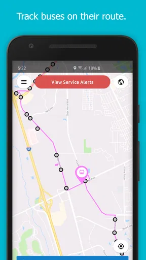
myStop® Mobile is a public transportation app designed to help riders find nearby stops, check routes, and view estimated vehicle arrival times. Depending on the transit agency using the platform, it may also provide service alerts, route maps, stop information, and trip-planning tools. Its exact features can vary by location, so select your transit system carefully after installing the app.
Does myStop® Mobile provide real-time bus or transit arrival information?
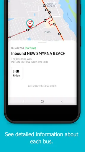
The app is primarily intended to display real-time or scheduled arrival information for participating transit systems. When live vehicle data is available, you can usually see estimated arrival times for selected stops and routes. However, predictions depend on GPS coverage, agency updates, network connectivity, and operational conditions. Delays, missing vehicles, or inaccurate estimates can occasionally occur.
Can I use myStop® Mobile for every public transportation system?
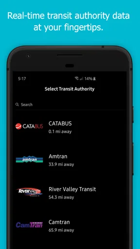
No. myStop® Mobile only works with transit agencies supported by the service. Availability, routes, stops, alerts, and other functions depend on the agency that has implemented myStop®. Before relying on the app, search for your local transportation provider in the agency list and confirm that the routes you use are included. Some regions may offer only limited information.
Does myStop® Mobile require an internet connection or location access?
An internet or mobile-data connection is generally needed to download current arrival predictions, service alerts, and route updates. Location access can make it easier to find nearby stops and identify your position on maps, although you may still be able to search manually by route or stop. If connectivity or location permissions are disabled, some features may be unavailable or less convenient.
Is myStop® Mobile free to download, and are there any privacy concerns?
The app is generally available as a free download, although normal mobile-data charges may apply when you use live maps or arrival information. Privacy details depend on the version and the transit agency’s configuration. Before installing, review the store listing and privacy policy to understand what information may be collected, such as approximate location, device data, or usage information, and adjust permissions according to your preferences.


